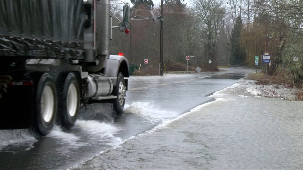
Heavy rainfall mixed with snowmelt on Vancouver Island has prompted the River Forecast Centre to issue a flood watch for most of the region, according to the Government of British Columbia.
The watch, issued Monday afternoon for south, east, central and west Vancouver Island, comes as locally rising river levels may exceed bankfull and cause flooding in adjacent areas, the centre says.
The North Island, meanwhile, is under a High Streamflow Advisory, meaning river levels are rising or expected to rise rapidly, but no major flooding is expected, though minor flooding in low-lying areas is possible.
The third in a series of storms passed through B.C. Christmas Day into early Monday, when 20-145 millimetres of rain fell across most of the region, with an extra 5-20 mm of snowmelt observed at local Automated Snow Weather Stations, the centre said in a notice.
Yet more heavy rainfall could be on the way, prompting worry as streamflow has already risen and remains high across the region, the centre says.
Environment Canada issued a special weather statement for East Vancouver Island from Duncan to Campbell River, where coastal flooding could damage infrastructure near high tide Tuesday morning.
The statement is also in effect for the Southern Gulf Islands, Sunshine Coast, Howe Sound and Metro Vancouver.
“High flows on Tuesday are anticipated to coincide with high tides, storm surge and high winds,” the Forecast Centre said, noting flood hazards in rivers at the outlet and ocean interface may intensify, particularly through the morning.
“This would include the Courtenay River, Englishman River, Cowichan River as well as other river outlets, particularly along the east side of Vancouver Island,” the notice states.
- Thousands without power on Vancouver Island as wind wreaks havoc: ‘The storm took out my lower deck’
Members of the Island-based Halalt First Nation reached out to CHEK News Monday voicing concerns about potential flooding, especially considering the Chemainus River runs through their Westholme/Crofton community.
“The region may experience a brief reprieve through mid-day Monday with another storm expected to move across the region tonight and tomorrow (Tuesday), bringing additional moderate to heavy rainfall and snowmelt,” the Forecast Centre added.
“Streamflow in the 2-year to 5-year range is anticipated in rivers throughout the region, however modestly higher flows are possible (e.g. up to 10-year levels).”
The Provincial River Forecast Centre has issued a Flood Watch for Central and Southern Vancouver Island. Please monitor the River Forecast Centre at https://t.co/5oQRW5P6si and Environment Canada at https://t.co/a8jl0keFq6 and visit https://t.co/pQAxnjdZoZ for proactive steps. pic.twitter.com/EEAvo4ig0b
— RDN (@RDNanaimo) December 26, 2022

