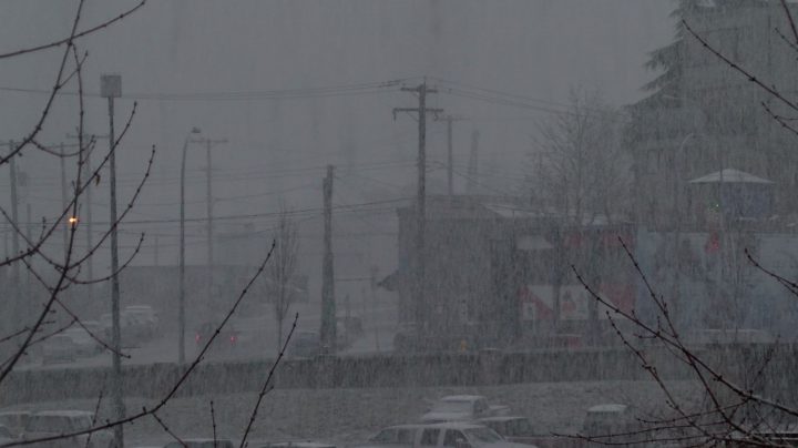
Heavy snow falls in Nanaimo on Dec. 29. File photo.
Parts of eastern and inland Vancouver Island are expected to receive five to 10 centimetres of snow overnight, prompting Environment Canada to issue a special weather statement on Friday afternoon.
The weather agency said a Pacific low-pressure system will approach the B.C. South Coast on Friday night. The mild, moist air will combine with cooler air from the B.C. Interior and cause mixed precipitation.
Rain is expected to start Friday evening then change to wet snow overnight as freezing levels drop. Heavy, wet snow between five and 10 centimetres within a short period of time is possible over east Vancouver Island.
The special weather statement is in effect for Courtenay to Campbell River, Duncan to Nanaimo and Nanoose Bay to Fanny Bay. All of inland Vancouver Island is also under the weather statement.
Environment Canada said snowfall amounts could vary widely and will be dependent on precipitation intensity and elevation.
Wind Warning for Greater Victoria
Greater Victoria was placed under a wind warning on Friday afternoon. Strong, southeasterly winds are expected to develop over the area on Friday night and into Saturday morning. Winds of 70 km/h gusting to 90 km/h are possible near the immediate coast.
The winds are expected to shift to 40 to 60 km/h near the Juan de Fuca Strait late Saturday morning as the system passes southern Vancouver Island.
Advisories for Vancouver Island Rivers
The BC River Forecast Centre has issued a high streamflow advisory for rivers across eastern and mid-Vancouver Island ahead of heavy rain expected over the weekend.
According to the forecast centre, heavy rain ranging from 50 to 160 millimetres is expected on Sunday and early Monday. Higher amounts of rain may be seen where there are upslope conditions and slightly lower amounts are expected along the eastern slopes of Vancouver Island.
Temperatures are set to increase and the freezing level will rise to 2,000 metres. Therefore, snowmelt may add to the runoff. River levels are expected to rise through Sunday with peak levels expected on Monday and possibly Tuesday. Rivers flowing out of lakes, such as the Somass River and the Cowichan River, are particularly susceptible due to the slow recession from last week’s storms.
The river forecast centre said the advisory is in effect for:
- Sproat River
- Somass River
- Tributaries and areas around Port Alberni
- Englishman River
- Tsolum River
- Oyster River
- Tributaries around Campbell River, Comox, Parksville and surrounding areas
- Chemainus River
- Cowichan River
- Koksilah River and surrounding areas
The City of Courtenay said it is deploying the Aqua Dam, which is temporary water-filled barriers, on Comox Road between Old Island Highway and the Highway 19A bypass near the Courtenay Slough. BC Hydro said there will potentially be high river levels from Jan. 27 to Jan. 30. The Aqua Dam is expected to be in place for several days.
We are working closely with #EMBC @CityofCourtenay @comoxvalleyrd @ComoxValleyEP on Comox Lake reservoir & Puntledge River flood risk mgmnt considerations for Sat-Mon #BCStorm.
— Stephen Watson-BC Hydro (@Puntledge) January 26, 2018
The southbound lane between Old Island Highway and the Highway 19A bypass near the Courtenay Slough will be closed for approximately four hours on Saturday morning while the city installs the Aqua Dam.

Maps showing aqua dams and tall walls in Courtenay. Credit: City of Courtenay.
Extreme Wave Hazard Advisory for Pacific Rim Nation Park Reserve
Parks Canada has issued an extreme wave hazard advisory for the Pacific Rim National Park Reserve. The public is asked to use extra caution on beaches, shorelines and coastal waters from Jan. 29 to Jan. 31.
During this period, large ocean swells reaching up to four metres are expected. Very high tides of up to 4.1 metres and a moderate storm surge expected during mid-day may compound the wave hazard. There may also be flooded beaches, floating logs, large waves breaking high up on shore and hazardous surf conditions. Parks Canada said the most dangerous part of the day is likely to be at high tide, from mid-morning to mid-afternoon.
Depending on the severity of the flooding, some beach parking lots and beach areas in the Pacific Rim National Park Reserve may be temporarily closed. Park visitors interested in viewing large waves are advised to go to the Kwisitis Visitor Centre’s Observation Deck at Wickaninnish Beach or the Florencia Bay Lookout.

