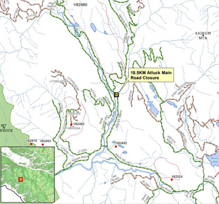
A map of the Atluck Main Road closure. The red lines show fire perimeters and the red dots show fire points. Photo Credit: BC Wildfire Service
The Atluck Main Road, located west of Atluck Lake and east of Tahsish-Kwois Provincial Park, has been temporarily closed at the 18.5-kilometre mark due to a nearby fire, the BC Wildfire Service said.
According to the BC Wildfire Service, the 1,070-hectare Tahsish Lake #2 wildfire has started to encroach on the road. The closure is to ensure the public doesn’t venture into the area and the firefighters stay safe.
The wildfire is currently classified as out-of-control. There are 23 firefighters, three helicopters and three heavy equipment working on the fire.
A total of 53 wildfires are burning north of Highway 28 on northern Vancouver Island. The BC Wildfire Service is once again reminding people that a campfire ban is in effect throughout the Coastal Fire Centre, with the exception of the “fog zone.” The fog zone is a two-kilometre strip of land along the outer coast of Vancouver Island, stretching from Owen Point (near Port Renfrew) north to the tip of Vancouver Island, and around to the boundary of the District of Port Hardy. This strip extends inland two kilometres from the high tide point.

