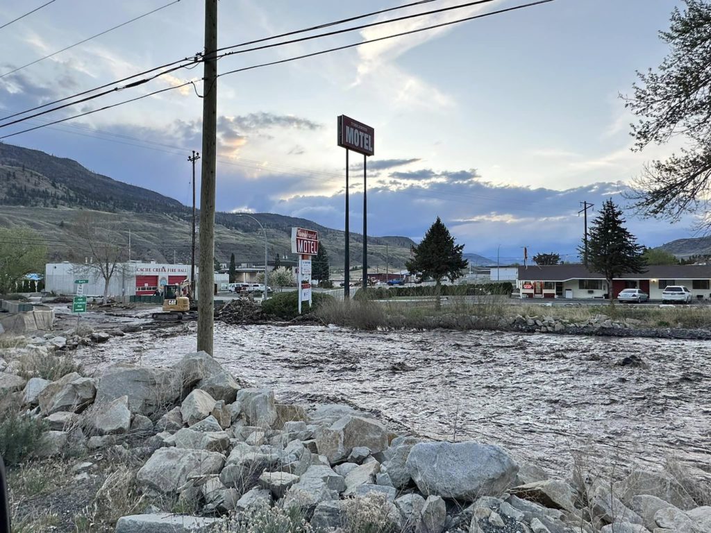
The mayor of Cache Creek says what’s normally a babbling brook has become a raging river, with floodwaters flowing right through the village firehall.
John Ranta says water levels are the highest he’s ever seen in the community located about 80 kilometres west of Kamloops in British Columbia’s southern Interior.
Snow at higher elevations is melting quickly, and with warm weather and rain in the forecast this week, Ranta says the flooding may get even worse.
He says one of five homes under an evacuation order is likely lost after the river flowed through the property, while others are subject to an evacuation alert.
Stretches of highways 1 and 97 have been closed in both directions, and Ranta says a river is flowing over where the two routes intersect in Cache Creek.
The mayor is urging residents to stay away from the creek that’s become a raging river, and says the community will get back on its feet in the near future.
“With the amount of water coming down … putting a few sandbags up is not going to save anything,” he says. “The water is going to go where the water wants to go.”
B.C.’s River Forecast Centre has issued a flood warning for the Thompson region that encompasses communities including Cache Creek, Lytton and Merritt.
A flood warning is also in effect for Whiteman Creek as it flows into the east side of Okanagan Lake, where the Okanagan Indian Band has issued an evacuation order for several properties in the Parker Cove neighbourhood.
Parker Cove resident Gordon Best says his home is far enough away that he’s not worried about flooding, but he’s never seen the waters of Whiteman Creek swell so much in his 15 years of living there.
“The creek’s been high before, but not like this,” he said Wednesday.
“It’s quite extraordinary.”
Lower-level flood watches cover the Okanagan, Boundary and Kootenay regions along with areas surrounding the Salmon River between Salmon Arm and Vernon.
The Regional District of Okanagan-Similkameen has activated sandbag centres.
A flood watch is also in effect for the middle Fraser River plateau, including areas around Quesnel and Williams Lake.
The forecast centre says snowmelt has been increasing, especially in mid-elevation areas, and rain is expected to follow warm, sunny conditions later this week.
In the north, high streamflow advisories are in effect for the Williston region as well as areas surrounding Prince George.
READ MORE: B.C. seasonal forecast suggests long cool spring, flood risk in high snowpack regions

